 New Orleans contracts out all the transportation work including streetcars, city buses and public school buses to outside vendors, who are mostly from out of state, so carpetbaggers are always asking where can I find a lot to park my buses. Not so fast. Any old vacant lot just won't do. Residential zoning won't work. What about commercial zoning? Nope. Of the 83 zoning districts in Orleans Parish, only 3 permit school bus parking: light or heavy industrial and marine industrial park. A conditional use is business industrial park, which requires city council approval and an application costing from $1,000 to $4,000, depending on the lot size. Classified as a Motor Vehicle Operational Facility, defined as a privately-owned facility for the dispatch, storage and maintenance of emergency medical care vehicles, taxicabs and other livery vehicles. A motor vehicle operations facility does not include facilities where the vehicles of the fire, police, or other municipal departments are dispatched, stored, and/or maintained, which are considered either public safety or public works facilities.
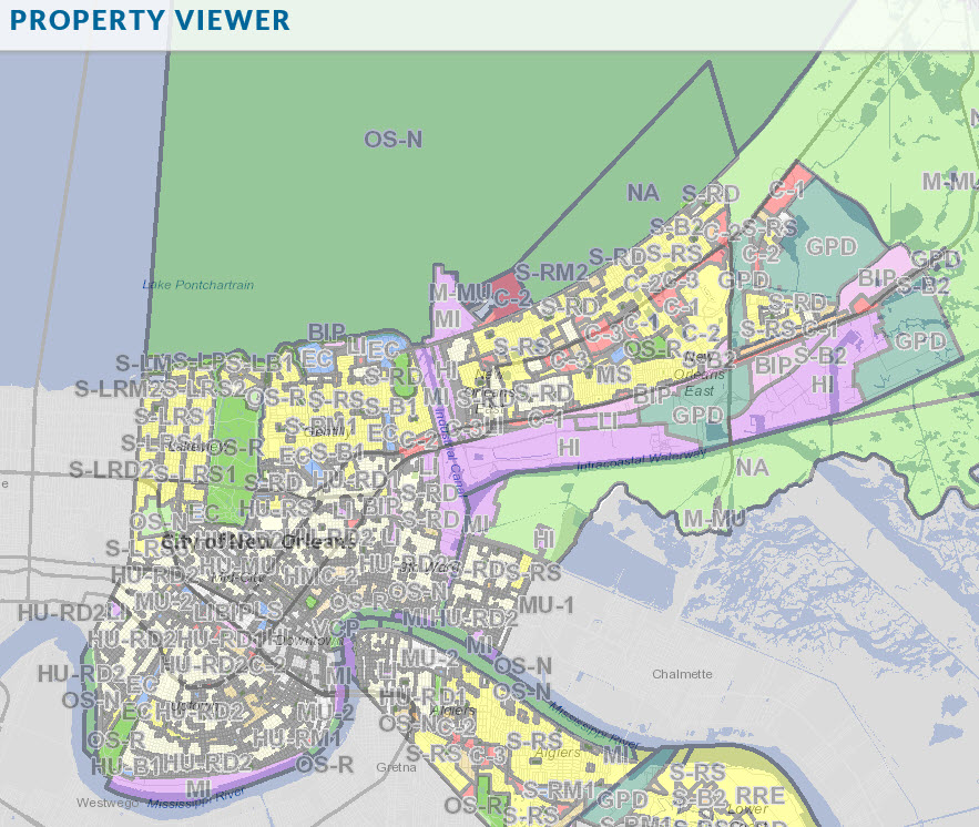
The map below shows in the purple areas the zoning allowed for parking, which is heavy and light industrial, business industrial park and marine industrial.

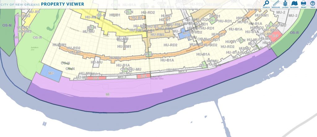
Parking is allowed only on the river side of Tchoupitoulas street, zoned marine industrial, and only the area behind the flood wall called Clarence Henry Truckway, owned by the Port of New Orleans.

 The purple shaded areas along the Mississippi River are zoned marine industrial but are all Port of New Orleans property and used as wharves. The is a small area on Claiborne Avenue near the Jefferson Parish line zoned light industrial, near the Lowes and Crabby Patty's.
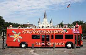
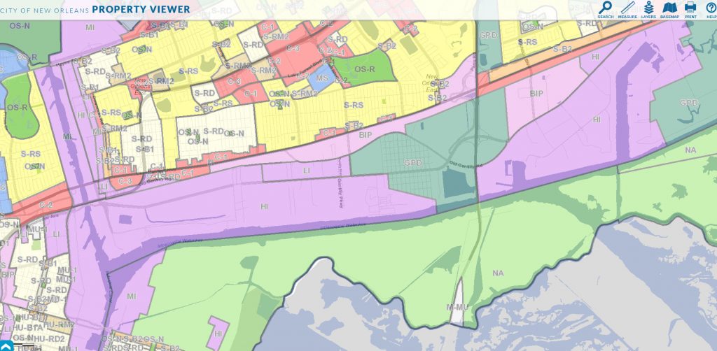
A second area zoned business industrial park surrounds the Times-Picayune warehouse, which is why they were not allowed to build apartments there. You can see tour buses parked in an old asbestos barn from I-10 at this district.

Nearly all of the companies that own school buses have fenced land where they park on Old Gentilly Road, zoned heavy industrial and shaded purple in the map below.

For additional information on zoning issues, pick from hundreds of insightful articles at LouisianaCommercialRealty.com
OS-N Neighborhood Open Space District
OS-G Greenway Open Space District
OS-R Regional Open Space District
NA Natural Areas District
GPD General Planned Development District
R-RE Rural Residential Estate District
M-MU Maritime Mixed-Use District
VCR-1 Vieux Carré Residential District
VCR-2 Vieux Carré Residential District
HMR-1 Historic Marigny/Tremé/Bywater Residential District
HMR-2 Historic Marigny/Tremé/Bywater Residential District
HMR-3 Historic Marigny/Tremé/Bywater Residential District
VCC-1 Vieux Carré Commercial District
VCC-2 Vieux Carré Commercial District
VCE Vieux Carré Entertainment District
VCE-1 Vieux Carré Entertainment District
VCS Vieux Carré Service District
VCS-1 Vieux Carré Service District
HMC-1 Historic Marigny/Tremé/Bywater Commercial District
HMC-2 Historic Marigny/Tremé/Bywater Commercial District
HM-MU Historic Marigny/Tremé/Bywater Mixed-Use District
VCP Vieux Carré Park District
HU-RS Single-Family Residential District
HU-RD1 Two-Family Residential District
HU-RD2 Two-Family Residential District
HU-RM1 Multi-Family Residential District
HU-RM2 Multi-Family Residential District
HU-B1A Neighborhood Business District
HU-B1 Neighborhood Business District
HU-MU Neighborhood Mixed-Use District
S-RS Single-Family Residential District
S-RD Two-Family Residential District
S-RM1 Multi-Family Residential District
S-RM2 Multi-Family Residential District
S-LRS1 Lakeview Single-Family Residential District
S-LRS2 Lake Vista and Lake Shore Single-Family Residential District
S-LRS3 Lakewood and Country Club Gardens Single-Family Residential District
S-LRD1 Lake Vista Two-Family Residential District
S-LRD2 Lakewood/Parkview Two-Family Residential District
S-LRM1 Lake Area Low-Rise Multi-Family Residential District
S-LRM2 Lake Area High-Rise Multi-Family Residential District
S-B1 Suburban Business District
S-B2 Pedestrian-Oriented Corridor Business District
S-LB1 Lake Area Neighborhood Business District
S-LB2 Lake Area Neighborhood Business District
S-LC Lake Area General Commercial District
S-LP Lake Area Neighborhood Park District
S-LM Lake Area Marina District
C-1 General Commercial District
C-2 Auto-Oriented Commercial District
C-3 Heavy Commercial District
MU-1 Medium Intensity Mixed-Use District
MU-2 High Intensity Mixed-Use District
EC Educational Campus District
MC Medical Campus District
MS Medical Service District
LS Life Science Mixed-Use District
LI Light Industrial District
HI Heavy Industrial District
MI Maritime Industrial District
BIP Business-Industrial Park District
CBD-1 Core Central Business District
CBD-2 Historic Commercial and Mixed-Use District
CBD-3 Cultural Arts District
CBD-4 Exposition District
CBD-5 Urban Core Neighborhood Lower Intensity Mixed-Use District
CBD-6 Urban Core Neighborhood Mixed-Use District
CBD-7 Bio-Science District
SC Suburban Corridor Use Restriction Overlay District
ENORC Eastern New Orleans Renaissance Corridor Use Restriction Overlay District
HUC Historic Urban Corridor Use Restriction Overlay District
Lower St. Charles Avenue Use Restriction Overlay District
RDO-1 Residential Diversity Overlay District (Marigny/Bywater)
RDO-2 Residential Diversity Overlay District (Tremé/Seventh Ward)
AC-1 Arts and Culture Diversity Overlay District (Frenchmen, St. Bernard, Broad)
AC-2 Arts and Culture Diversity Overlay District (Freret, Newton, Teche)
AC-3 Arts and Culture Diversity Overlay District (St. Claude)
AC-4 Arts and Culture Diversity Overlay District (Tremé)
RIV Riverfront Design Overlay District
CPC Character Preservation Corridor Design Overlay District
EC Enhancement Corridor Design Overlay District
CT Corridor Transformation Design Overlay District
GC Greenway Corridor Design Overlay District